 |
|
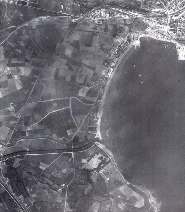
An aerial photograph taken on the 1st May 1943, with the top of the photograph facing north, showing part of Syracuse (top right) and the Ponte Grande bridge (towards the bottom, just left of centre). Running from left to right, the River Anapo (above) and Canal Mammaiabica (below) can clearly be seen under the bridge. At the extreme left of the picture the railway bridge can also be seen; the long straight line proceeding north-north-east from the Canal is the railway line. Only the eastern sector of LZ-3 can be seen in this photograph, running from west to east between the railway and the Ponte Grande bridge, and about half the distance between these to the south of the Canal. Photographs such as this one made it appear as if the zone was an open space, empty of obstacles and therefore ideal for glider landings. A closer look, however, would have revealed an imposing network of low stone walls. Copyright: Taylor Library.